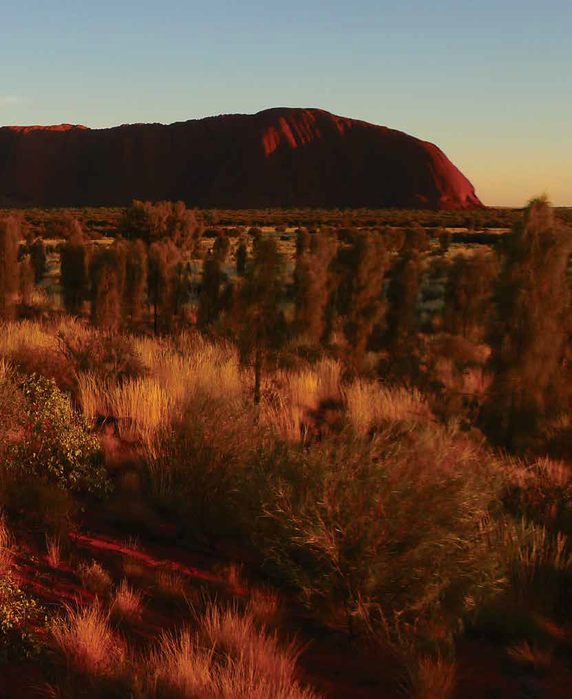
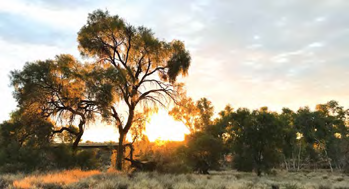
Uluru at sunrise
Heading out on the Big Lap of Australia or, in our case, the Half Lap, is exciting and daunting at the same time.
Have we remembered everything? Do we have the right gear? Will our motorhome make it? Which way do we go?
We live in Adelaide, so our choice of direction is easy — up through the middle of the country to Darwin and then we can go east or west. We only have three months, so our journey takes a faster pace than most nomads would stand for.
As we discovered along the way, planning is essential for peace of mind, but the unexpected is often the best part.
Come along for the ride. If you’re new to life on the road, you might pick up some tips. If you’re an experienced nomad, it might jog some memories and you’ll get a giggle.
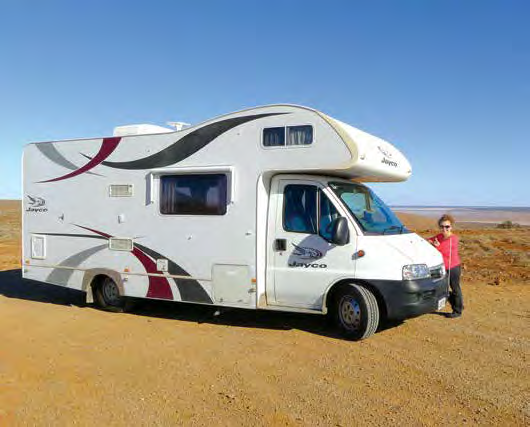
DAY 1 - Adelaide to Port Augusta (307km)
First stop, Port Wakefield for the first of many bakery breaks.
We head up through Lochiel, Snowtown and Port Germein on Augusta Highway to Port Augusta. There are a lot of nomads here as it’s a huge crossroad for travellers heading north, south, east or west.
After reaching the tip of the Spencer Gulf, explorer Matthew Flinders said there was “nothing to see” and no need for anyone to follow after him. We’ll see.
Stay: Discovery Park, Port Augusta
DAY 2 - Port Augusta to Mulga Well Rest Area (315km)
You can tell we’re new to this nomadic lifestyle. The park was full last night but by the time we’re ready to go, it’s empty. We’re still faffing with water hoses and electric cables while those who know what they’re doing are a few hundred kilometres up the road.
The sun is out and it is a glorious winter day after a near-freezing morning. We check out a few shops for extra water and spare hose fittings — part of hubby’s hardware store addiction.
The scenery changes constantly from bushy scrub to low-lying saltbush. Mountain ranges in the distance break up the horizon and road signs warn of roaming cattle and sheep.
One constant is the rich red dirt of the outback.
Just out of Pimba is a huge pink salt flat at the base of rounded hills - an island lagoon with just enough water to create pretty reflections.
We make our first attempt at free camping. We try to push all thoughts of the Wolf Creek movie aside and pull up in a rest area. Impending sunset helps with the decision, as does the roadkill warning us of the number of kangaroos active at this time.
Our first free camp is not a great example of how people look after these free rest areas. We discover the ‘poo’ tree, sadly you couldn’t miss this massive bush covered in loo paper. If there’s no loo, and you’re not self-contained, ‘Dig. Do. Bury and Burn’.
Stay: Mulga Well Rest Area (27km north of Glendambo).
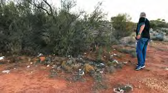
The ‘poo tree
DAY 3 - Mulga Well Rest Area to Coober Pedy (228km)
We saw three eagles dining on fresh roadkill; four rolled, wrecked, burnt and graffitied cars; and one poor emu caught in a fence, his long legs contorted around the wire. We freed him and he was so exhausted he didn’t even try to peck us (Terry at Josephine’s Gallery and Kangaroo Orphanage in Coober Pedy organised a rescue mission).
About 40km out of Coober Pedy, the moonscape begins. Mounds of dirt, remnants of thousands of opal mining shafts, dot the landscape.
It’s unforgiving country, hot, dry, vast. How do they know where to dig for opal?
We’re told not to venture into mine sites (the moonscape) for fear of falling into a pit or annoying a prospector. Signs warn photographers not to step backwards when trying to get the perfect shot, while locals warn photographers not to go anywhere near the shafts for fear of getting shot!
At first glance, Coober Pedy, home to about 2000, looks dusty and unwelcoming. Tired looking shops line the main street. Many are closed, or appear that way until you see someone gesturing from the darkness to come inside.
But, as we find, you have to dig a little to find the best bits.
All the action is below ground level — it’s the best way to avoid the heat. There are underground churches, hotels, a book store and tourist attractions.
The Old Timer’s Museum and Faye’s Underground Home offer a glimpse into the history of opal mining and the pioneers who made Coober Pedy what it is today.
Stay: BIG4 Stuart Range Outback Resort is a huge, packed caravan park, and we get the last powered site. It’s the outback so costs 20c for 2-minute showers and 20c for 40 litres of treated bore water.
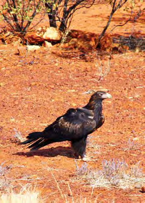
Wedgetail eagle
DAY 4 - Coober Pedy — Painted Desert
We are lucky to meet local Wayne Borrett, who takes us to the Painted Desert in his 4WD.
We are worried about what the roads are like and if our big motorhome would make it. As it turns out, we could have made it — with a fair bit of rattling and a decent sports bra — but we got the advantage of local info as well.
Stay: BIG4 Stuart Range Outback Resort.
DAY 5 - Coober Pedy to Marryat Creek rest area (413km)
This is a big day of driving. First stop, the Breakaways. With the colours and rugged nature of the outback, it’s mesmerising.
We pass Cadney Homestead and Marla. Lots of nothing, but still not boring.
Stay: Marryat Creek free camp. There’s rubbish everywhere but we discover (after blaming fellow travellers) it’s pigeons pulling trash out of the bins. After lighting a fire with wood collected from the dry creek bed, we watch the sun set through the scrub.

Kulgera Pub and its clothesline
DAY 6 - Marryat Creek to Kings Creek Station (388km)
When crossing SA/NT border we stopped and took the obligatory pics.
We then head through Kulgera where the roadhouse, its ceiling covered in hats and bras, doubles as a pub and caravan park and the clothesline out front is loaded with old sandshoes.
Erldunda is where you turn left towards Uluru and Kings Canyon. There’s a roadhouse, motel, campground and 40-odd cars and vans lined up for fuel. Phone reception finally returns (Optus) — Telstra has better reception along this stretch of road.
Closest fuel from here is 260km away at Uluru, or at Kings Creek Station, 236km away.
To get to the station, follow Lasseter Highway (State route 4) to Luritja Road then turn right, all sealed roads.
Stay: Kings Creek Station. Great stop and cheaper than the Kings Canyon resort. You can hire quad bikes and take helicopter rides. Red dirt, powered sites, hot showers, BBQ, camp kitchen outdoors, a washing machine and an open-air sink, reception for phone and WiFi, cafe for meals, and fuel available.
DAY 7 - Kings Canyon to Curtin Springs (218km)
It’s 40km from the station to Kings Canyon and on the way we saw our first wild camel.
At Kings Canyon we walked the two-hour North Rim return loop. Hard yakka but could have done the whole lap — I think they mark up the ratings of the walks for the ‘least fit’ hikers.
Lots of steep steps cleverly made to look like part of the rocky escarpment. Then the well-marked tracks use the natural terrain. Rugged rocks make perfect steps and platforms.
There are views over vast plains until you get into the heart of the canyon, then it’s red cliffs and canyons for as far as you can see.
The Garden of Eden is an oasis lodged at the base of the canyon walls. Water collects here but you can’t swim.
A one-way gate stops anyone on our walk from getting to the garden — you have to do the whole rim walk to get access. We thought about jumping the gate, but there were cameras.
There is good drinking water available at start and end of the walks plus an information board to help make smart choices. Take fly nets, they’re gold in the outback.
Heading to Curtin Springs (then Uluru) back along Luritja Road then right on to Lasseter Highway.
We get our first glimpse of Uluru — or is it Fooluru?
Mt Connor fools many people, but if you can see it from the road to Curtin Springs, it’s not Uluru.
Stay: Curtin Springs. Free camping with $3 honesty-system showers, toilets plus an open-air restaurant and bar.
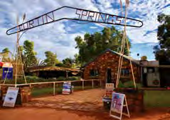
DAY 8 - Curtin Springs to Uluru (80km)
A short drive then check in at Ayers Rock Resort (Yulara) campground (there is only one) and fluked a powered site with hubby’s senior discount (don’t tell him I mentioned that).
We drove to Uluru and bought a two-day pass ($25 each) at the entrance to the national park.
A Cultural Centre visit explains Anungu Aboriginal history. There’s also a cafe and art and crafts for sale. A small ‘shield’ serving dish costs $200 but a good coffee for $6.
We drive 44km from Uluru with a dune sunset viewing area along the way to see Kata Tjuta (The Olgas).
Walpa Gorge is a 2.8km return loop walk; it's amazing but you need to be sure-footed. The rocky path is melded together by nature with some extra man-made bridges — especially towards the end where the rock faces meet and the gorge ends.
Trees are green and vibrant, not the usual ‘outback olive green’. The walls have massive cave-like holes where vegetation now clings to life.
On the ground are boulders which have dropped out of the side of the cliff, creating those caves.
Even those boulders are a conglomerate of different rocks all melded together — maybe by heat?
Back to Uluru for sunset drinks. There’s a special carpark set aside for visitors who all have the same idea. Sadly the sunset is dodgy with grey skies, but there are still nice colours on Uluru.
Stay: Yulara campground.
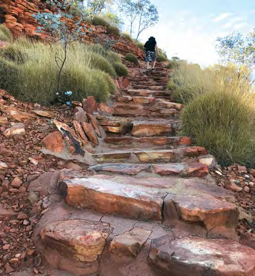
The hike at Kings Canyon
DAY 9 Uluru to Desert Oaks Rest Area (304km)
We are up at ridiculous o’clock (4:50am) because we expected a lineup at the viewing area for sunrise at Uluru. But, the only others are three tourists from Hong Kong who had driven 25 hours from Melbourne.
It’s pitch black, nothing in sight. No-one in sight, actually, until 6.50am when a stream of cars and buses full of tourists turn up — half of them try to stand in front of us.
Sunrise is soft and pretty — another side to this monolith. Back to the base of Uluru for the free guided Mala Walk.
Our guide Adam, an Indigenous ranger, tells the story of the Mala people and the significance of Uluru to their culture. It’s an important ceremonial meeting place with special areas for women and men and uninitiated men. It was also a ‘nursing home’ of sorts where the oldies would rest and cook kangaroos.
Uluru is sacred according to Adam. A ceremonial pole used to be carried up the path that, until last October, was chained to help tourists do exactly what the indigenous people did not want visitors to do – climb Uluru.
Now the climb is closed and the focus is very much on learning more about the local culture, geography and geology.
We learn, for example, that 900 million years ago, only algae and bacteria existed in the area; 350 million years ago a massive earthquake twisted land, lifted rock and turned it on its side. Uluru the monolith was created – extending 348m above and 6km below the surface.
Tourism here is interactive with segways, push bikes, walking tracks, guided walks, helicopter flights and hot air balloons.
In the middle of our tour, some poor bloke collapsed and they had to call an ambulance. Good reminder to wear sunscreen, a hat and drink plenty of water.
At 1:45pm we leave Uluru to see how far north we can get before dusk.
Stay: Desert Oaks Rest Area, 38km north of Erldunda, is a good, clean site with an undercover picnic area, clean toilets and water. Free camping is growing on us, especially now we have a better idea of how long the house batteries will last.
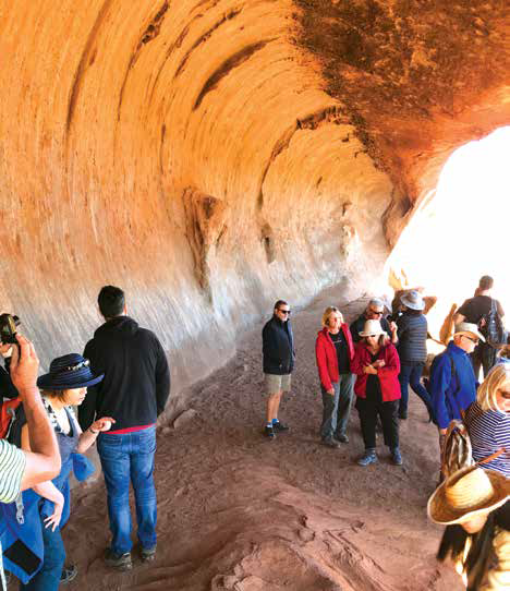
Exploring Uluru on the Mala walk
DAY 10 - Desert Oaks Rest Area to Alice Springs (170km)
We’re surprised at the mountainous landscape. Anyone expecting vast open plains will be amazed —mind you, there is a lot of nothing as well.
The Finke River is dry, but the rest area would be lovely when the river is flowing.
We head into Alice Springs through the gap in the MacDonnell Ranges where the Ghan enters.
A quick scan of town reveals Todd Mall is dead quiet — there’s more action in the supermarket.
Stay: BIG4 Alice Springs.
DAY 11 - Alice Springs to East MacDonnell Ranges (150km return)
Allow a whole day to head east, more if you can spare the time.
The road is close to the MacDonnell Ranges — about 74km from Alice to Ross River Resort. The plan is to stop at the sites on the way back to town. Ross River homestead was built in 1898. Now it’s a bar (with saddles as seats), dining room and communal lounge.
Facilities include cabins and powered and unpowered sites. Fuel is available, but at almost $3/litre it’s outrageously expensive.
The manager is quite a character. He wants to put fuel up to more than $3 a litre because he doesn’t want to sell it, he would rather keep it to use on the property.
He doesn’t want to tell me his name and I’m not sure I’d believe him anyway. He tells people he’s the cleaner so that they don’t expect anything of him.
In summer he puts a note on the door to “see the bloke in the pool” if they need anything. Then tells them to “rack off” (I’m being polite) because it’s too hot to get out of the water. All in good humour. I think.
There are a lot of nearby walks. The Scenic Walk behind the homestead and up the hill offers a view of the property wedged between ranges.
Is it home of Ross River virus?
No. Apparently there are eight Ross Rivers in Australia and this one is not responsible for the virus.
On the way back to town, the first stop is Trephina Gorge. We did the 2.5km gorge walk loop. There’s a lot of steps, half are natural and the rest are made to look that way. The riverbed is hard work but gives perspective of how tall the cliffs are, with massive trees growing out of rock crevices.
Next was Jesse Gap. A highlight is Aboriginal paintings with fat white stripes depicting emus.
Emily Gap, next on our list, is culturally significant to Indigenous people, with rock art depicting the Three Caterpillars that were eaten during Dreamtime.
Back into Alice, we head up to ANZAC Hill for night view.
Stay: BIG4 Alice Springs is worth the money. Gotta love a motorhome where you can just pull up at the end of a long day and not have to set up anything. Just plug in and relax.

A dingo taking a stroll in Ormiston Gorge
DAY 12 - Alice Springs to West MacDonnell Ranges (235km)
We head west today, all the way to the end of the sealed road along the West MacDonnell Ranges to Glen Helen Gorge and then back, hitting the tourist hotspots.
Glen Helen Gorge has water in River Finke and then more in the Gorge, a rare site up here. We walk along riverbed, surrounded by reeds, to the gorge and an expanse of water that cuts through the cliffs. We can’t get to Organ Pipes today unless we want to swim and walk 15 minutes.
At Ormiston Gorge is the Ghost Gum Walk — up hundreds of steps to a lookout, then down a rugged trail to the riverbed and remnants of water.
Black footed rock wallabies bounce around the cliff face, defying gravity. It’s mating season so the activity is frantic, and not easily explained to curious kids laughing at the antics.
We climb over huge boulders in the creek bed — it’s not for the fainthearted. Tall cliffs all around, ducks are in the water and there’s a dingo!
At the Ochre Pit, we traverse a 300m path to ochre pits with spectacular colours of ochre, yellow and black. Don’t be tempted to dig or take any earth — it’s a $5000 fine.
Next is Serpentine Gorge with an easy 1.1km walk to see this animal refuge, a beautiful water hole across rocky dry riverbed.
Stay: Standley Chasm Caravan Park. We arrived at dusk. The kiosk normally closes at 5pm but has extended hours in peak season. Five powered sites in the caravan park (more a carpark), just across from the main kiosk/restaurant. If you stay the night, site fees include the entrance fee, so it’s a bargain.
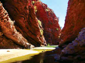
Simpsons Gap in the West MacDonnell Ranges
DAY 13 - Standley Chasm to Alice Springs (20km)
At Standley Chasm we can’t leave without doing the tranquil 20-minute stroll along a good, flat path to the chasm.
Beautiful old river red gums line the path, gnarled by years of hardship. Many have collapsed but caught by cliff face and are still alive, just hanging in there.
Standley Chasm has been 2.2 billion years in the making. It was once a crack in the cliff wall, a weak spot where water got in and eroded it into a river.
Noon is best time to visit when the sun overhead lights up the cliff walls, but it’s also the busiest time.
Our last stop in West MacDonnell Ranges is Simpsons Gap.
It’s a short, easy stroll to the Gap where there is water and lots of birds and rock wallabies.
The 20km stretch back to Alice Springs feels like it’s going on forever, the battery light won’t go off and Murphy’s Law is telling us it’s a faulty alternator, not a faulty light.
Stay: Alice Springs Tourist Park, fees apply – for the next four nights while waiting for a replacement alternator.
Category: Features
Written: Fri 01 May 2020
Printed: May, 2020
Published By: