The Wanderer

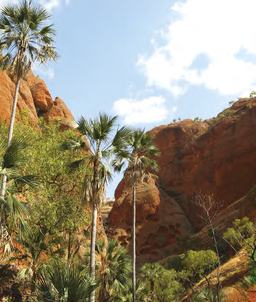
Geikie Gorge near Fitzroy Crossing
As we left Darwin we could tell the season was starting to change. It was very hot (over 36°C every day), the humidity was increasing and we started seeing high clouds during the day. It was early September, that’s spring in most parts of Australia, but the seasons work differently inside the tropics.
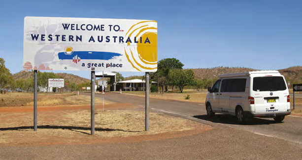
From Katherine we were back on the last leg of the Savannah Way heading for Broome. As we crossed into WA on the way to Kununurra we ran straight into the border quarantine inspection. Out went all the fresh fruit and vegies that we stocked up on before leaving Katherine. In exchange we were given back an hour and a half as we changed time zones. Fair swap I suppose. There’s another way to tell you have left the NT, the speed limit suddenly drops from 130 to 110 for no practical reason at all. But if you believe the road safety propaganda, travelling at the legal speed limit in the NT would kill us all. And it’s not as if the Territory’s roads are safer than other states. It just shows how arbitrary the regulators’ attitudes towards road safety are.
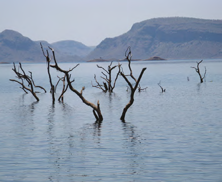
Kununurra, on the Ord River, is the eastern gateway to the Kimberley region. It’s a relatively new town, built in the 70s as part of the Ord River irrigation scheme. On arriving, our first task was to work out what to do next. The easy answer was to take a cruise on Lake Argyle, so that’s what we did. It was a very pleasant way to spend half a day, especially as they provided barbecue fish, and beer and wine for lunch. There is also the option to make a day of it and link the lake cruise with a trip to or from Kununurra on the Ord River. Lake Argyle was formed when the Ord River was dammed in 1972 to provide irrigation water for a massive agricultural development in Australia’s north-west. It turned out to be a bit of a white elephant because the agricultural development on the scale originally envisaged is still waiting to happen. Just 29,000 hectares are currently being irrigated. By comparison, the Murrumbidgee Irrigation Area in NSW covers 660,000 hectares. But Lake Argyle is vast. Its volume is equivalent to about 21 Sydney Harbours and it has a shoreline that is 950km long. The lake cruise took us along the north western shore and past several islands but it’s impossible to see more than a fraction of the lake in the three hours that we spent cruising.
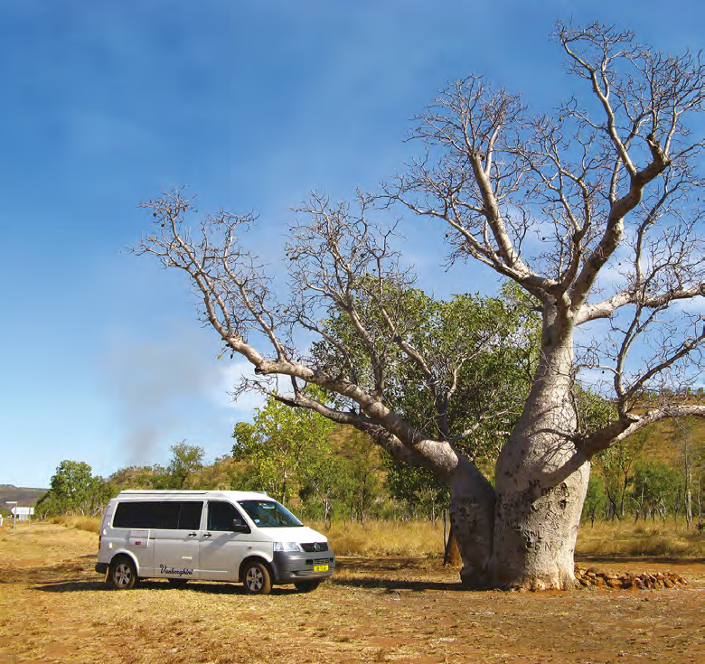
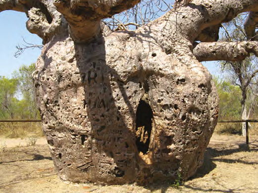
Classic Kimberley boab tree near Kununurra
On September 8, we drove back to Kununurra from Lake Argyle and things started to go seriously wrong. Slava had to travel back to Sydney urgently for family reasons. So we drove overnight to Darwin so she could catch the first direct flight back to Sydney, leaving me on my own in Darwin for at least a few days while we worked out what needed to be done back home.
On my second day back in Darwin I started to feel warm humid air blowing through the Vanbo’s air-conditioner. That might be a minor thing in some parts of the country, but in Darwin in September during the monsoon build-up when the temperature and humidity are high, it was a show stopper. The parts weren’t available locally and it was two and a half weeks before I was able to resume the trip. I managed to occupy myself in Darwin in the mean time. I visited all the things we didn’t get around to when we were there a fortnight before. Places like the Botanic Gardens, Charles Darwin National Park, Hidden Valley Motor Raceway, Corroboree Billabong, Lee Point, Parap Markets, East Point and the Military Museum. By the time I resumed my travels on September 25 it was exactly 25 weeks and 22,000km since I left home. At that stage I was hoping to rendezvous with Slava in Broome around 10 days later so she would only miss out on part of the Kimberley.
Although I was covering old ground on the drive back to Kununurra, I had the opportunity to see a few things we had passed up the first time, like the escarpment walk at Victoria River and the rock art near Joe Creek picnic area. I even returned to Mirima National Park on the outskirts of Kununurra to get some better photos in the morning light. From Kununurra I headed to Wyndham.
Wyndham is 100km north west of Kununurra. It’s one of those places you need to visit just to say you’ve been there. Apart from the Big Croc, the Big Boab Tree and the Dreamtime Sculptures, there isn’t much reason to go there, except that fuel was 20c per litre cheaper than Kununurra. Maybe that is the town’s way of attracting tourists. There is also the Five Rivers Lookout. From the top, on a clear day, you can see the King, Durack, Ord, Pentecost and Forrest rivers as they flow into Cambridge Gulf. The day I went there wasn’t clear and I could only barely see the Gulf.
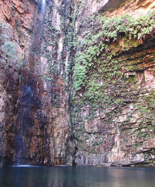
Rockpool at Emma Gorge on the Gibb River Road
On the way back down the Great Northern Highway I did the short detour to The Grotto. If you can manage the 140 steps (each way) there is a fabulous rock pool that is reputed to be over 100 metres deep. In the wet season it also creates a spectacular waterfall. On the 40-degree day that I visited, I was satisfied just to have a swim and cool off.
Further down the Great Northern Highway I came to the start of the iconic Gibb River Road which is the alternative road to Broome. The first 33km is bitumen which got me as far as the turn-off to El Questro (don’t bother looking up what it means; it’s a made up name). It’s an 870,000 acre working cattle property that has been adapted as a tourist resort to capitalise on its natural beauty. It’s not cheap but if you don’t go there you’ll kick yourself later. I had the option of a night at the Homestead but passed it up at nearly $3000 per night. I’ll do it next time with Slava. The road from the Gibb into El Questro is 16km of good gravel. Once in there, there’s lots to do. On my first afternoon I seriously challenged the Vanbo by driving up the steep and rocky road to see the sunset from Saddleback Ridge. Back in the campground a young German backpacker came over to talk. It turned out he was an automotive engineer with VW and couldn’t wait to tell the guys back home, who designed the Vanbo, about the road he had just seen me conquer. It is a remarkably capable vehicle. Next day I drove out to Zebedee Springs. That was when it dawned on me that the property had been extensively burned very recently (50 percent of it as it turned out). There were stumps still smouldering everywhere. That probably accounted for all the smoke haze that blocked my view at the Five Rivers Lookout at Wyndham. The livistonia palms at Zebedee Springs were all burned, giving it a post apocalyptic look rather than the usual palm-filled oasis. I went for a plunge anyway just to sample the warm 32-degree spring water.
Set your clocks back and give us all your fruit and vegies
El Questro’s highest profile feature is its eponymous gorge. On the drive in I couldn’t get past the first creek crossing because the water level was too high for the Vanbo. As it turned out, I couldn’t have got past the second creek crossing either, for the same reason. It wasn’t too bad though, it just added a 25-minute walk (each way) through burned out savannah. A substantial part of the gorge had been burned out as well. But the deeper I walked into it, the less burned it was. I scrambled as far as the second waterhole where there was a solitary red ochre rock art figure. In the afternoon I took the tour to Explosion Hole on the Chamberlain River which returned via Branko’s Lookout to watch the sunset with wine, beer and nibbles.
Next morning, after leaving El Questro, I walked up Emma Gorge to the prettiest rockpool underneath a waterfall that was struggling to keep flowing at the peak of the dry season. After that I was back on the Great Northern Highway, heading to Broome.
Prison tree near Derby
The Bungle Bungles (Purnululu National Park) must the most under rated natural wonder in Australia. It is one of only two World Heritage sites in WA and was proclaimed in 2003. It is recognised as the most outstanding example of cone karst sandstone anywhere in the world. In both scale and grandeur it is the equal of Uluru and Kata Tjuta. Except the 50km road into the Bungles is a disgrace. You need to be equipped for an off-road expedition to attempt it. I left the Vanbo and hitch-hiked in. I walked the Cathedral Gorge in the south and Echidna Chasm in the north. Unfortunately, the people who gave me a lift blew all four shock absorbers on the way back to the highway, shook their two-way radio antenna to bits and bent the sump guard in a most unnatural curve. It was a very expensive trip for them.
When I travelled between Hall’s Creek and Fitzroy Crossing it was the 28th anniversary of the sealing of the final 290km of Highway One around Australia. When you think about it, 1986 isn’t that long ago really. The big attraction at Fitzroy Crossing is the Geikie Gorge. I did a late afternoon cruise on the gorge. It’s unique in this part of the world because it’s made of limestone and not the usual sandstone. This results in the walls of the gorge having a sculpted appearance as the stone is dissolved by the annual floods.
Derby is another one of those towns I visited just to say I’d been there. Its claim to fame is that it has the biggest tides in Australia. They result from the shallow King Sound and the way the tides funnel in there. Derby also has one of the Kimberley’s two Boab Prison Trees just on the outskirts of town (I’m glad I didn’t drive 50km off the Gibb River Road on dirt to see the other one).
Broome is the last point west on the Savannah Way. Cable Beach matched the hype with its white sand and azure water. Broome is the home of the Australian pearling industry and has a rich history. It was a beautiful place to finish my drive through the Kimberley before I turned south through the Pilbara and along the west coast to Perth. Sorry to be so brief about Broome, but I only spent one day there before Slava and I agreed that she wasn’t likely to re-join me on the trip and I should cut it short by two months and come home.
I had pre ordered and paid for a new set of tyres to be fitted in Karratha, in the Pilbara. According to Google maps, the quickest/shortest way back to Sydney from Karratha (without going back up to Halls Creek and crossing the Tanami Desert) is to go via Perth. So, technically, I will complete The Big Lap in a Little Van. It’s just not going to be very scenic from here on, but hang on for the ride as I drive half way around Australia in the next seven to 10 days!
Category: Unknown
Written: Wed 01 Apr 2015
Printed: April, 2015
Published By:
Lake Argyle,
WA
-16.074177,
128.754327

TOUR COSTS
Lake Argyle lunch cruise: $99. Check out the available tours at the Kununurra Visitors Information Centre.
Explosion Hole Tour at El Questro: $100. Other tours are available, check the website www.elquestro.com.au
A day trip to the Bungle Bungles is available from the Turnoff Campground just off the Great Northern Highway. Check to see if the tour is operating after September. Cost is $285pp which includes a full day tour with walks to the major features plus lunch and dinner.
ACCOMMODATION
Take your pick between commercial camps and free camps throughout the Kimberley. I lashed out and stayed at El Questro. Check the website for its different accommodation options and prices but expect to pay around $30pp per night for a powered site plus $20 each for awilderness permit. www.elquestro.com.au
PERMITS
A national park pass is worthwhile for $44 for one month or $88 for a year ($55 with a senior’s discount). Passes are available from visitors information centres everywhere in WA. Entry to individual national parks is $12 per vehicle.
ALCOHOL
Alcohol restrictions apply throughout the Kimberley and many towns are ‘dry’.
CROCODILE SAFETY
Estuarine and freshwater crocodiles potentially inhabit all waterways in the Kimberley. Check the warning signs and be careful.
ROADS
The classic road in the Kimberley is the Gibb River Road; it is 660km and is not sealed past the turn-off to El Questro. I drove the alternative Great Northern Highway to Broome which is sealed all the way. The road into the Bungle Bungles was a shocker and should only be attempted in an appropriate vehicle.
WHEN TO VISIT
The wet season in the Kimberley should be over by May. It starts getting hot (over 36°C in September) the first storms arrive in October and the wet starts around December.

ROB HARDEN N61452