The Wanderer
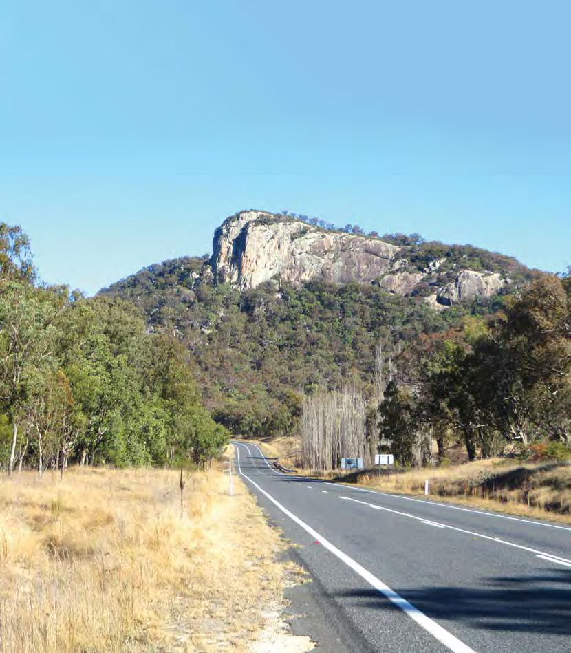
New England Highway: The open road awaits.
It was late winter when we drove from Ballina towards Tenterfield, New South Wales, then onto the New England Highway, heading south in our 2014 Jayco Conquest camper. In the past three months we had been through inland Queensland, along the Tropic of Capricorn, through the Gem Fields and Coal Fields, as far north as Bowen, seen family in Brisbane and the Sunshine and Gold Coast, before making our way south to our home in Tasmania.
On entering Tenterfield, the first thing we saw was a sign to a cork tree – a large, old, very gnarled, but surprisingly healthy looking specimen. According to the sign, the tree was brought from England and planted in Tenterfield in 1861.
We like to take a walk around the small towns we pass through. You never know what you’ll see. In Tenterfield we commented on the number of people sitting around talking in the street. It was nearly midday. Suddenly the street came alive with children from a nearby school, parading for all to see, dressed up as story book characters. It must have been ‘Book Week’.
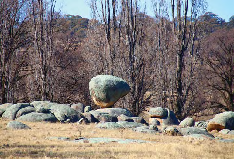
Balancing Rock sitting pretty at Glen Innes
We generally don’t plan where our overnight stops will be. When the day is nearing its close, we look around to see what is available and we are rarely disappointed. We found a beautiful free camp off the highway just north of Glen Innes. It was where we experienced our first really cool night.
Our camper is quite well insulated, but in the morning it was minus one inside. It was at least a few degrees below that outside. John got up and fired up the diesel heater, then we stayed cosy under the covers until the temperature rose. The pipes were frozen, the toilet was frozen, and the camper was covered in a thick layer of ice. We didn’t dare think about the engine. We weren’t expecting such cold. It certainly never gets that cold where we come from in Tasmania.
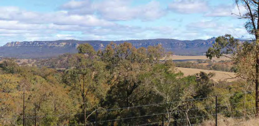
Magnificent views from Burning Mountain
After thawing out, we drove into Glen Innes. The engine started first pop as usual, never missed a beat, and no tell tale drops of water on the ground.
Surprisingly, on traditional Aboriginal land, at the local recreation ground in Glen Innes, there was a standing stone circle of Celtic origin, with an Australian twist. It was similar to the ancient stone circles found in Great Britain. The standing stones were a little more recently placed than the British variety, but with a little history attached. Unlike the British ones though, the stones still have their cutting marks. They were arranged in a precise fashion to mark directions of the compass, extra stones marking the exact direction of the sun for the summer and winter solstice. Further on, we stopped at the spectacular natural phenomenon Balancing Rock, with its huge boulders balancing on top of each other, and more boulders strewn over a large area.
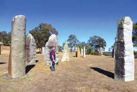
The Celtic origin standing stone circle at Glen Innes
In Armidale, we stayed at a great MSO (Member Stop Over) on a farm just out of town and saw a little of how our farmers are struggling with the drought. It was another cold frosty morning, at plus one inside the camper. We were trying to trace a friend in the area. Sure enough he was known to the members and we were able to track him down as we headed south towards Tamworth, with an overnight camp near the McDonald River at Bendemeer.
We stumbled across the Wallabadah Free Camp, which is quite a popular little overnight spot, but the main attraction for us was the First Fleet Gardens right next door. It was a strange place to find a garden dedicated to the First Fleet which landed in Botany Bay, Sydney area, in 1788. Sydney is hundreds of kilometres south. The gardens were set out with shade sails to look like a sailing ship, eleven circular gardens representing each of the First Fleet ships, with a cobblestone pathway connecting the gardens. Each garden displays a stone tablet with the names inscribed of those who came on that ship. The memorial seems to be there by default. According to the sign, the idea was rejected in other parts of New South Wales. Interestingly, it claims to be the only memorial to the First Fleet that lists the names of all the people who sailed on it.
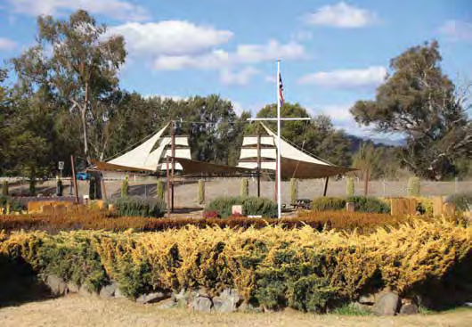
Ship-like shade sails at the First Fleet memorial at Wallabadah
Reading the story of not only the First, but Second and Third Fleets, it seems to be a really sad tale of deprivation, cruelty, and death. Those who made it alive to Botany Bay must have made a pretty tough human foundation for our country.
From Wallabadah, we took a diversion to Quirindi, the nearest dump point. Back on the New England Highway we saw a sign to Burning Mountain Nature Reserve. Curiosity got the better of us. It was time for lunch anyway.
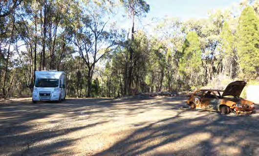
An overnight stop at Bylong Way (luckily we didn’t suffer the same fate as our neighbour)
Burning Mountain is the common name for Mount Winginis, a naturally ignited coal seam that has been burning for thousands of years, claiming to be “one of the only examples” of a burning coal seam in Australia. It was first noted by Sir Thomas Mitchell in 1829, the same man who was mentioned as having climbed Mt William in the Grampians in Western Victoria in 1836, among other places. He really got around.
We parked on the most level spot we could find, left the fridge going and set off on the 4km walk to the summit and back. It was a beautiful warm day with blue sky and dry as dry, not a blade of green grass to be seen. It hadn’t rained for ages.
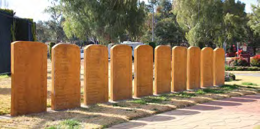
Monuments to remember members of the First Fleet
We started our walk with a local wildlife kick, kangaroos resting under a thicket of trees, then we started to climb. According to the signs the coal seam is burning about 30m below the surface and has been progressing at about a metre a year for the last 6000 years. It was a weird landscape. In areas the earth has been baked by the heat of the burning coal. The vegetation takes a long time to re-establish. We could see the progression of the fire as we moved up and across the mountain. One area, looking like a natural “brick pit”, was the result of claystone rocks made of sediment that had been subjected to intense heat from the burning coal seam. The heat had baked the rocks into a bricklike hardness. This strange walk culminated at a viewing platform where we could see the heat shimmering from an area of white and red loose rock with a strong smell of sulphur hanging in the air.
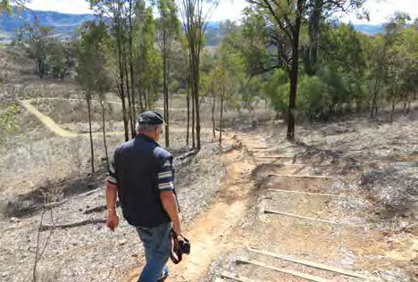
Taking a stroll through Burning Mountain Nature Reserve
Continuing south we left the New England Highway at Muswellbrook, and headed for the Bylong Way through to Bathurst. We thoroughly enjoyed the drive along the New England Highway, full of unusual things to see and do. Unfortunately we missed refuelling at Muswellbrook, planning to do so at the next town down the road.
The Bylong Way took us through a beautiful valley then into the mountains. After a roadside stop for the night we set off with the fuel gauge suddenly calling for fuel in 65km or else. According to the GPS, the nearest fuel stop was 69km away and we were heading up hill, not good for fuel conservation measures. The pressure was on to refuel, but that’s another story.
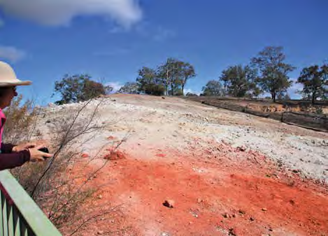
Red hot earth baked by the burning coal beneath
Category: Destinations
Written: Mon 01 Apr 2019
Printed: April, 2019
Published By:
-29.762978,
151.732771
GETTING THERE
The New England Highway runs for 878km from Hexham at Newcastle, New South Wales, to Yarraman, north of Toowoomba, in Queensland. It forms a large chunk of the inland route between Brisbane and Sydney.
Sue and John Turner travelled the New England Highway in their 2014 Jayco Conquest camper, stopping in Tenterfield, Glen Innes, Armidale, Wallabadah, and Mount Winginis, before turning off at Muswellbrook.
MORE INFO
• Australian Standing Stones: www.gleninneshighlands.com/australian-standing-stones.
• Search ‘First and Second Fleet Memorial Garden’: www.visitnsw.com to find out more about about the memorial gardens.
• Burning Mountain Nature Reserve: www.nationalparks.nsw.gov.au/visit-a-park/parks/burning-mountainnature-reserve.