The Wanderer
Anyone venturing into South Australia’s northern regions will attest it’s a land of boom and bust. Signs of past settlements remind us of times when flourishing agriculture turned into heartache. The Gawler Ranges region is such a place but for many travellers it’s forgotten, not even scoring a mention on the South Australian Government tourism site.
Being off the radar might be the best thing for those visitors who seek it out, because it means less crowded campsites as you take in genuine treasures of an outback experience.
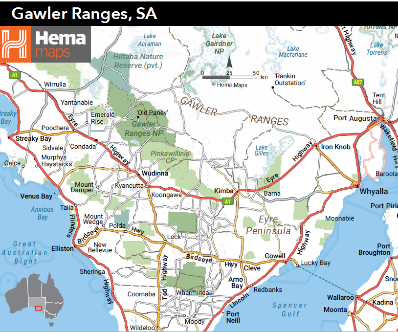
The region is about 600km northwest of Adelaide and is bordered along its southern extension by the Eyre Highway, which was named by the first European tourist to the area, Edward John Eyre, in 1839. It was on this journey he noted the Sturt’s Desert Pea, which he described as “a most splendid creeping plant.” The flower is now South Australia’s state emblem and can be found throughout the area after good rainfall, which, with an annual average at 295mm, is infrequent. Interestingly, the first European record of the flower was actually by William Dampier in 1699 on the West Australian coast.
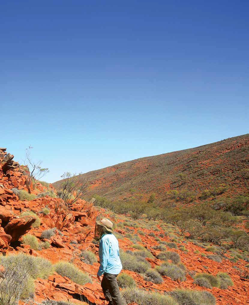
Eyre named the scenic arid hills after the SA governor of the time, George Gawler. The highest point in the ranges is Nukey Bluff at 465m, and although some of the higher peaks have mountain names, whether they’re genuinely mountains is questionable. Formed from volcanic flows millions of years ago, the landscape is a weathered expanse of rocky gorges with only seasonal water flows.
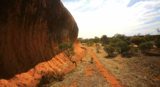
Extensive displays of exposed rhyolite columns throughout the area are the most broadly spread examples in the world. Commonly known as organ pipes, they feature in many gullies and are particularly spectacular in the late afternoon when the setting sun brings the colours to life.
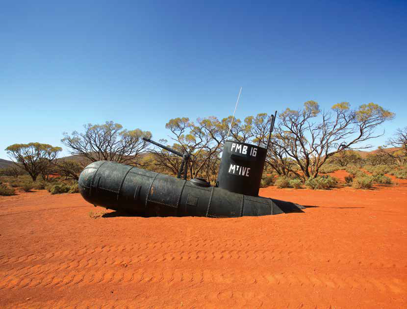
The ‘submarine’ at Mt Ive Station
The Malkaripangala Aboriginal people named areas like Yandinga, Wanginny and Barngala. Clashes between the colonisers and Aboriginal occupants, however, led to police outposts being established on Paney Station and the takeover of traditional waterholes like Policeman’s Point. With the loss of hunting grounds and access to water the Aboriginal population was decimated.
Because of the region’s dryness, Eyre was doubtful of the agricultural potential, but pastoralists started moving into the ranges after a couple of years of good rain. Paney Station was established in the 1850s, and the seasons at this time were so abundant that nearby Nonning Station was shearing 90,000 sheep. In a display of heroic optimism, the licensing agreement with the government was to maintain 19 sheep per square kilometre.
Unknown to the settlers, the good times were temporary. As a result, the land was then abandoned — this process was repeated over the following decades according to the seasons.
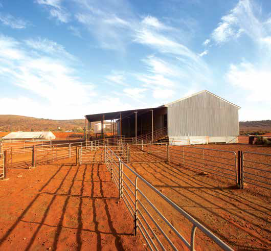
Old buildings at Mt Ive Station
MT IVE STATION
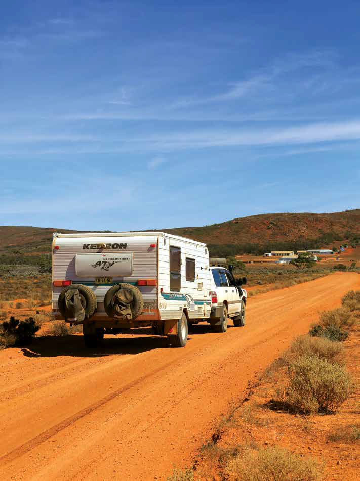
Our exploration of the ranges began a few kilometres west of Iron Knob with a sign into Mt Ive Station, our destination for a few days. It was 128km of reasonably maintained gravel road but with stretches of awful corrugation. We use a Hema HS7 for navigation, so the route was straightforward, but nothing prepared us for the entry into Mt Ive.
Emerging from the red plains just to the side of the road is a halfsubmerged big, black submarine, complete with conning tower and a deck gun. It is incongruous in the extreme but an unmistakable marker for anyone visiting.
We later discovered that back in 2007, a visiting Lions Club thought it would be a great lark to build the unlikely monument from a disused Brambles water cart that had been lying abandoned for many years.
Mt Ive Station was founded in 1864 when Price Maurice set up camp on 900sqkm in the northern perimeter of the ranges with a herd of sheep and a stack of hope. Facilities for tourists visiting nearby Lake Gairdner were established in the '90s and have been gradually improved to offer a seemingly endless variety of offroad tracks and accommodation, ranging from powered and unpowered campsites to stone cottages with motel facilities. There's no mobile phone reception, but Internet is available outside the cookhouse for emails and WhatsApp.
I was told the reception area and the larger accommodation block with the common room and kitchen came from Maralinga when the atomic testing site was decommissioned. After hearing this, it occurred to me that the reason my hair was standing up after a shower was less to do with the artesian water than radioactivity.
Current owners Joy and Len took over in 2002, adding the station to a collection of properties on the Eyre Peninsula. Fodder and sheep are swapped between the drylands and the more productive farms depending on the seasons. In bumper times, Mt Ive can carry as many as 9000 sheep and their lambs, but with drought conditions over the last three years stock is down to 2500, or less than two per square kilometre — it shows the unreal expectations of the early settlers.

Rhyolite columns
The station offers paid access to the southern shore of Lake Gairdner. A key to a locked gate is available at reception for the length of your stay and the 35km trek is suitable for 2WD vehicles.
After unhitching the van and setting up camp we decided the lake would be our first objective. With the aid of a station map, we found an impressive stone dam built in 1892 and rhyolite pillars best seen in late afternoon sun.
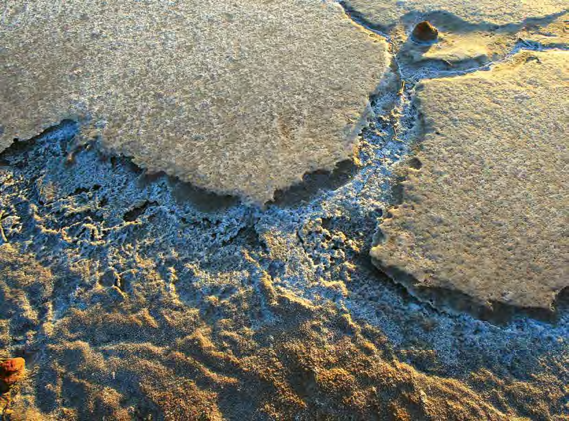
Views of a brilliant white glow in the distance herald your approach to Lake Gairdner, but it's not until you arrive at the hills adjoining the salt that the vastness is apparent. At 160km long and 60km across, Lake Gairdner is our third largest salt lake. Up to 1.2m deep, the salt is the dried remains of an ancient inland sea that covered land as far away as Cape York.
A shed on the hill owned by the Dry Lakes Racers Association (DLRA) had undercover seating and a welcome picnic area when we visited a second time for the sunset.
Although visitors are forbidden from driving on the lake, DLRA runs annual events in autumn when hundreds of competitors and around 3000 spectators from around the world arrive to test a variety of exotic machines over a six-mile course. Les Davenport set the fastest ever official speed on the lake of 555km/h in his supercharged streamliner in 2018.
Timing markers stretching into the distance on the salt are visible from the hill, and on closer inspection, we found they have been secured with tech screws driven deep into the rock-hard salt.
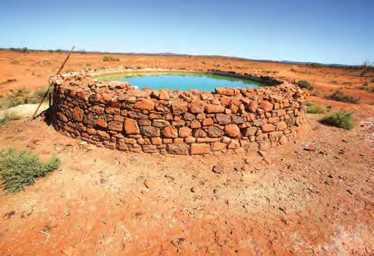
The stone tank at Mt Ive Station
LAKE GAIRDNER NATIONAL PARK
We found open access to the lake about 30km north of Mt Ive through Yardea Station. Free camping is available in a large shady area about 300m from the shore. A sign at the entrance suggested a walking track to the top of the nearby hill, and although we found the start of the walk at the end of the car park, the trail petered out after a few hundred metres and there was no suggestion of any promised interpretive signs.
However, a cross-country hike to the top of the hill rewarded us with stunning views for miles. The sight of an expanse of blue water about 500m from the shore was too hard to resist, and we were soon out on the salt where the wind was blowing the 3mm deep water towards us at a fast clip. It’s an otherworldly experience on the vast expanse of salt where even the flies left us alone, and the only sound was our own breathing.
On the way back to Mt Ive, we explored Pondanna Ruins, not far from the road at the intersection of Yardea and Moonaree roads. The magnificent stone structures include tall fireplaces and deep wells on a lonely plain in the middle of nowhere. The ruins are the remains of shearing quarters and a cookhouse from the 1880s, and stand as a stark reminder of the many abandoned efforts at settlement in these remote places.
The roads are unsealed but largely trafficable by 2WD
GAWLER RANGES NATIONAL PARK
In 2002 the SA and Australian Governments combined to purchase Paney Station and parts of Scrubby Creek and Pine Lodge Stations to create the 163,500ha Gawler Ranges National Park. The park is an important example of the environment between the southern mallee country and the arid centre further north.
From Mt Ive, head west past the lake road then through Thurlga Station to the park entrance. The last 30km was a poorly maintained, rocky and corrugated track that required very slow going with the van in tow.
Wildlife abounds in good seasons, and the park is home to some 140 bird species including Major Mitchell cockatoos, ringneck parrots, wedgetail eagles and flocks of emus. Among the list of threatened birds in the park is the only protected population of the short-tailed grass wren, discovered only three years ago.
With luck and stealth, you might be fortunate enough to encounter a rare yellow-footed rock wallaby, but both red and grey kangaroos are common, and we found evidence of the hairy nose wombat.
Like most dry regions, the best time to find wildflowers is in spring when crimson mallee and native grasses blossom. While there are over 400 species of plants, a couple, like the Gawler Ranges Hop Bush and Gawler Ranges Grevillea, are found only here.
Zooming in on Lake Gairdner
Seven camping areas are scattered throughout the park in various scenic or historic locations, and signposted tracks give access to most high clearance 2WDs. Other tracks are marked for a 4WD experience through the hills and interconnecting ranges, and we had no trouble on any of the roads still hooked up to the van, although wet weather would be a different matter.
An expansive ranger station at Paney Station maintains park roads and limited facilities, and regularly patrols the labyrinth of tracks. Nonetheless, signs warn of the need to carry sufficient supplies of food and water, and you are expected to take your rubbish home with you.
Our first stop was the corrugated iron Paney woolshed and shearers quarters that are available for accommodation. The shed is in good shape with shearing stands and an old wool press.
From the woolshed, a drive along the 4WD-only road through stands of black oaks leads to Kolay Hut campground set in a shady glen. The huts include a restored cement block shack and an older tin structure, and there are toilets and even a shower. A walking track leads to the Kolay Minica Falls, which are said to be spectacular when it runs, but are also worth a look anytime for the striking red rock formations.
Gnarled peppercorns shade the yard at Old Paney Station where a drink on the verandah must have been a homely relief after a hard day’s work. Nearby Policeman’s Point was said to be the site of the original police outpost, and the waterhole at the foot of the gully was a significant Aboriginal gathering point in times past.
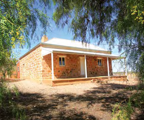
Old Paney Station
PILDAPPA ROCK
We chose to head south to Minnipa on the Eyre Highway before heading back home and found the 20km section before the shire maintains the roads to be a shocker. But before we made it back onto the blacktop, the Hema navigator had one last surprise for us. Pildappa Rock showed as a point of interest, and soon signs pointed the way.
The rock is a formation not uncommon in the Eyre Peninsula. As humorous as it sounds, the configuration is an inselberg, the weathered tip of a granite dome as deep as seven kilometres below the surface. While similar in shape, Uluru is arkose sandstone with iron pigments to give the rocks the same colours, and unlike the Central Australian icon, climbing on the Pildappa is welcome.
At the base, chemically weathered formations 100m long rival other ‘wave rock’ attractions and on the top natural gnamma holes formed ancient water supplies. A road winds around Pildappa, and there are picnic facilities, toilets and a large campsite.
Pildappa Rock
THE WRAP
It might be easy to ignore the Gawler Ranges, or to rush through them as a quick sidetrack on your cross-country odyssey. I have to admit to passing by several times, too intent on getting where I was going. After our recent journey through this unique and historic area, though, I can see it deserves a more thorough investigation. There is so much to take in, it’s worth setting aside a few extra days to visit, or it’s even worth a special trip. I’m putting Speedweek on my 2021 calendar and adding in some additional days for another look around.
Category: Features
Written: Mon 01 Jun 2020
Printed: June, 2020
Published By:
Gawler Ranges,
South Australia
-32.565629441584704 ,
135.11077021636214
Getting There
The Gawler Ranges are in South Australia, 200km west of Port Augusta. Access if off the Eyre Highway from Iron Knob, Kimba, Wudinna or Minnipa.
When to Visit
In late autumn and winter, the pack is green and refreshing, perfect for campfires and bushwalks. After rain, the creeks flow and most pools are alive with aquatic life. From later winter into spring, the park teems with wildflowers in incredible shapes, sizes and colours.
In spring, you can see the brilliant flowers of local crimson mallee, and the plains are carpeted with native grasses and bluebush. Summer can be scorching, but if you are prepared to work around the weather, you will have calm days, extraordinary sunsets and unobstructed views of the starry nights.
National Parks and Booking Information
Port Lincoln Natural Resources Centre
Camping prices vary. Phone 08 8688 3111 or email deweoponlinebookings@sa.gov.au.
Mt Ive Station
Camping fees apply. Phone 08 8648 1817 or visit mtive.com.au.