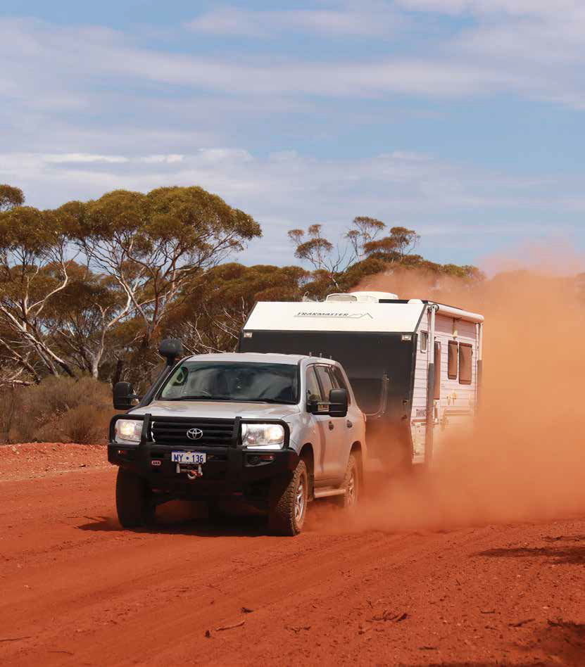
Travelling on the dusty road between Mulline and Riverina
When you’ve already checked out the attractions around Kalgoorlie-Boulder in the Western Australian Goldfields, you’re probably ready to do something different. To help visitors get a feel for the area’s history, intrigue and nostalgia, while taking in some great outback scenery and wildlife, a wonderful local discovery trail is proving extremely popular.
In 1892 and 1893 the Eastern Goldfields area hit the headlines when gold was found. Mostly coming on foot with no more than bare essentials (pick, shovel, swag, cooking utensils, water and meagre supplies), hardy prospectors hoping to make their fortune arrived in their thousands. Over 100 years later, the regions are continuing to produce more gold than those old timers could have ever dreamed of.
While many of the early settlements and shanty towns no longer exist or are virtually ghost towns, there is still plenty to see and do, and with the creation of the Golden Quest Discovery Trail, it’s possible for visitors to follow in the footsteps of explorers and prospectors from the comfort of their modern vehicles!
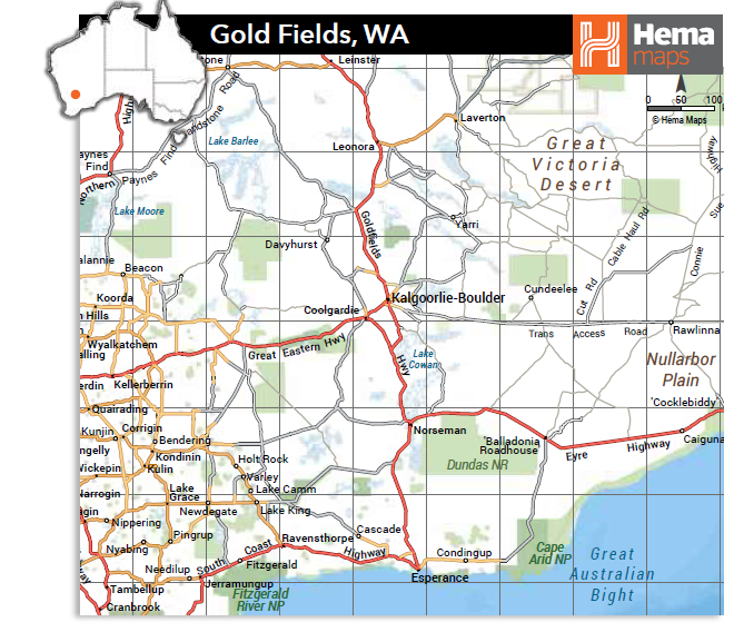
A comprehensive 160 page spiral bound trail guide, which comes equipped with an audio accompaniment in the form of two CDs (available at the Goldfields visitor centres and other outlets for $39.95), details the trail which sets off from Coolgardie in a 965km loop and finishes on the famous ‘Golden Mile’ and Super Pit Lookout in Kalgoorlie.
Coolgardie was the early administrative centre for the Eastern Goldfields and still retains plenty of history and charm, so is an ideal place to start the trail. Before heading out of town, make sure you check out some of Coolgardie’s lovely old buildings, its enormously wide main street designed to allow wagon trains to turn around, the old railway station, the wonderful indoor and outdoor museums, the fully restored Warden Finnerty’s residence and the well-kept Pioneer Cemetery.
The trail organisers suggest a minimum of three days with overnight stops in Leonora and Kookynie, but it really is up to you. There are a number of places along the way where accommodation is available or simply pick one of the campgrounds and enjoy several nights out under the stars. Also, to fit in with road conditions at the time you are free to vary the suggested route as you go, as we did.
On the trail there are over 25 signposted sites with information boards providing a wealth of knowledge about each place and the people who lived, worked and died there. The whole trail is littered with ghost towns, run down and remote cemeteries (some in the process of restoration), rusting machinery, abandoned mine shafts, and old buildings in various stages of disrepair. There are too many places to detail, but we have endeavoured to cover the main highlights — you will quite likely find plenty more of your own.
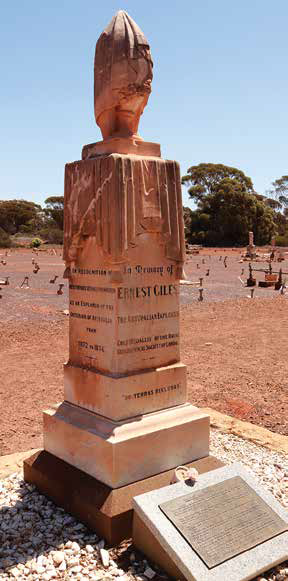
The gravestone of explorer and pioneer Ernest Giles
ALONG THE TRAIL
Following a sealed then a good gravel road north of Coolgardie, the trail first passes the old Bonnievale townsite where a dramatic rescue of a miner from a flooded mine took place in 1907. Further on is the ruin of the impressive Premier Hotel at Kunanalling. Virtually all that is left of the town, it is worth checking out and is where you can also find the story of a shady, heavy drinking caveman character linked to a double murder — quite chilling.
Accounts of early explorers who passed through this countryside are dotted along the trail. At Ularring Soak, for example, Ernest Giles found a valuable supply of water at the base of a large granite outcrop. While he and his small party camped here, it is reported that they were attacked by a ‘grand and imposing army’ of over 100 Aboriginals, ‘painted, feathered and armed to the teeth’. None of Giles party was harmed and the report referred to the ‘routed army carrying their wounded and disappearing behind nearby trees’. Subsequent enquiries, however, have thrown doubt on what actually happened and whether the tribe had any hostile intentions, particularly as it was also reported the group had already spoken to several Aboriginals and had seemingly befriended a young Aboriginal girl. No one will know what really went on back in October 1875, but it adds a little bit more intrigue to this lonely, but attractive granite outcrop setting.
Further up the road one of the trail’s most unusual surprises awaits. On Lake Ballard, a large salt lake, is a most unusual international art project costing over $600,000, called ‘Inside Australia’. Spread over several square kilometres of the usually dry lake bed is fifty-one steel stick-like representations of human figures created by British sculptor Antony Gormley. Although hard to believe, the figures are individually based on reduced body scans taken of local residents of Menzies. This curious location was chosen to represent the heat, loneliness, wide-open space and sheer remoteness of the desert landscape. This is a fascinating, eerie look into the world of abstract art, and for most visitors it leaves more questions than answers. If you are camping here in the adjacent campground, by torchlight the statues make a truly memorable and haunting sight.
Leonora is the largest town in this northern section of the trail, and there are a variety of accommodation, services and supplies available. Nearby is the old settlement of Gwalia which still retains some of its original buildings. The huge open cut mine, still in operation in underground tunnels, can be seen from a lookout and the museum on the hill overlooking the mine is also well worth a visit.
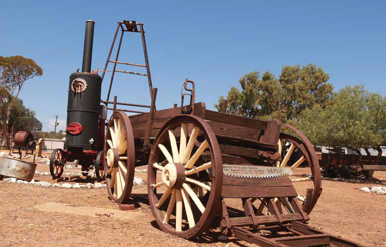
Mining equipment at the open air museum in Coolgardie
The township of Laverton marks the turnaround point of the trail. Fuel, services and accommodation (including a caravan park) are available here, as is the Explorers Hall of Fame. Also in town is the statue and story of Laverton’s Hero, Dr Charles Laver, after whom the town was named. As well as being a prospector, Laver was the region’s local doctor, and in this capacity rode his bicycle hundreds of kilometres to and from remote mining camps to treat the sick. The old police station complex including the gaol is also worth checking out via a short tour (small donation) provided by volunteer caretakers and is a great insight into policing what was one of the country’s roughest and wildest towns.
As the trail swings westwards, some of the features worth exploring are the old railway bridges near Malcolm and the remnants of nearby town of Mt Morgans. Named after Alfred Morgans, the WA premier who lasted a month, Mt Morgans has a particularly interesting history. In fact, the establishment of the town involved a formally conducted race in November 1899. Men, women and children — on horseback, bicycles, in buggies or on foot — covered a distance of just over 14km from the main street of nearby Mt Margaret township to peg blocks of land in the new township where a gold deposit had been found. By 1903, Mt Morgans was a thriving centre with some 500 buildings and 1,250 residents. In those days miners regularly moved on from one mine or strike to another. It’s reported that in just over a month most of Mt Margaret had been demolished and moved to Mt Morgans, which by 1903 boasted some six hotels including the Royal Hotel which was moved and rebuilt from its former location in Mt Margaret, a brewery, ice works, plus a Workman’s Club, numerous stores and chemists. Now the Mt Morgans Municipal Chambers, built in 1900, is the sole surviving structure.
The next stop is Kookynie, which once had a population of over 3,500 people but now has about a dozen defiant, hardy souls, some of whom can usually be found in the town’s only remaining pub. The Grand Hotel, with its resident horse Willie often greeting visitors at the doorway, has been continuously trading since 1902 and provides a caravan park and camping area behind the hotel. Staff and locals here are always happy to fill you in on plenty of local history with a yarn or two about the place and its colourful past. Around town, or what is left of it, the ruins of the Cosmopolitan and National Hotels are worth a visit. As you explore, it is hard to remember this place once had two newspapers, four confectioners, eleven coffee places, a couple of cordial factories, several banks and churches, a hall, a brewery, a ‘red light’ (brothel) district and seven brass bands to keep the population entertained! Also worth seeing near Kookynie are the fascinating granite outcrops Balancing Rock, Split Rock and Hanging Rock.
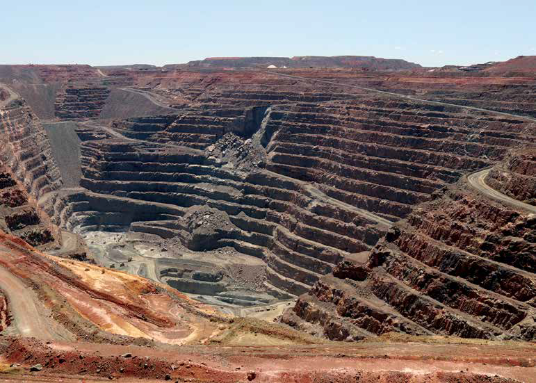
The super pit in Kalgoorlie is a fascinating place to finish the Discovery Trail
As the Discovery Trail meanders out of town, other tales come to light, like the story of Niagara Dam, constructed in 1897 with cement carted 220km by 400 camels. The dam was commissioned because of a severe lack of water at the nearby booming settlements of Niagara and Kookynie and would also be used as a supply of fresh water for the railway locomotives that would soon be linking Kalgoorlie and Menzies. It cost the then enormous sum of £62,000 ($124,000) but was never used because a plentiful supply of good underground water was discovered at Kookynie around the time of its completion. The dam, now a delightful picnic and camping spot, became a real ‘white elephant’ of the day.
Much of the background information on the Discovery Trail along with plenty of photographs, personal stories and illustrations is included in the Trail Guide book and accompanying audio tracks. What’s not can easily be gleaned, sometimes flavoured with wit and imagination, from locals you’ll find along the way. The guide also has maps, distances and guidelines on travel times, stopping points and even an indication on how much time to allow at each location.
Further south, the town of Menzies still retains some of its original character with its lovely Town Hall building, the Menzies Hotel and a handful of other historic buildings. A recent local project has seen the erection of a number of metal sculptures around town based on pioneers of the past, each with inscriptions telling their story. While here, the old Menzies Cemetery is worth a look with plenty of interesting stories and some unique headstones made of tin.
The old Goongarrie Station Homestead is a popular spot to camp. A lovely 3km bush walk trail here gives visitors a good opportunity to see some of the local gimlet, blackbutt and salt gums and to enjoy the prolific bird life in the area. The camping facilities include toilets, hot showers, picnic tables and fireplaces/barbecues. Camping fees apply and cottage accommodation is also available.
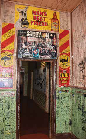
A well autographed wall in the Broad Arrow Tavern
This area not only has a history of gold mining, but it was also part of the coach route and is rich in Aboriginal culture, like a number of other places along the trail. A number of colourful stories about sandalwood and of the hardy sandalwood cutters, some of whom are still making a good living here in the goldfields, can also be discovered.
Onwards to the old settlement of Siberia and then not far away is the Ora Banda Historic Inn, originally built and owned by comedian and entertainer Alf Garnett in 1911. This once iconic pub made headlines back in 2000 when Gypsy Joker bikie Billy Grierson was shot dead across the road after an altercation at the pub. Don Hancock, former WA police chief and owner of the Ora Banda Hotel at the time, was suspected of the shooting. Soon after the pub was subject to a bomb attack and the Hancock’s residence was torched. A year or so later Hancock was killed along with Lou Lewis in a revenge car bombing outside his home in Perth where he had moved. The pub, meanwhile, was sadly gutted by fire in May 2019 and today, with only its external walls still standing, it’s a sorry sight indeed. The current hotel owner, Mike Lucas, is hopeful it can be rebuilt in time.
A little further on, another ‘must’ is to call in and have a drink or cuppa at the much ‘autographed’ Broad Arrow Hotel. Everywhere you look the walls, doors, ceilings and even dunnies are all covered in writings, autographs and stories. This old pub is also famous these days for their wonderful ‘Broady Burgers’ — they are delicious!
As the trail heads further south towards Kalgoorlie, a short side trip to see the old cemetery at Paddington provides plenty of historic interest, and just a few kilometres out of Kalgoorlie a signposted track leads to an old bush two-up ring. In recent years the old ring was only used on special occasions, but with a revival of interest and special approvals, two-up is held here once a week on Sunday afternoons. These events are indeed great occasions, well patronised with a food van stationed outside and hundreds of dollars won and lost on each toss of the coins.
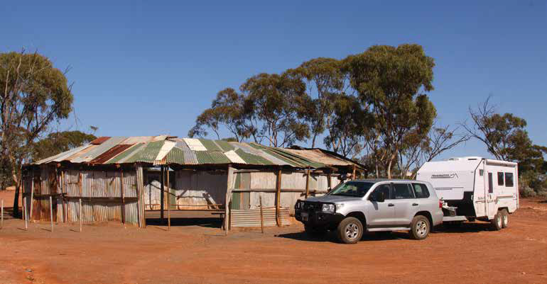
Pulling in to Kalgoorlie at the end of our trip
On the edge of Kalgoorlie, the Hannan’s North Tourist Mine, also incorporating the Mining Hall of Fame, is a must see where the full history of this fabulously rich mining region is laid out. There is the opportunity to experience an underground mining operation and ‘gold pour’, and you can even have a go at panning for gold.
With the Golden Mile and a visit to the Super Pit Lookout now in front of you, you have reached the end of the Golden Quest Discovery Trail — an exciting adventure that links the goldfield’s historic and memorable past with its present and even includes glimpses of what is to come in the future. Whilst in the historic town of Kalgoorlie- Boulder, check out the centre’s many old buildings including the Kalgoorlie-Boulder Museum, the old pubs and ‘skimpies’, the infamous Hay Street brothels (one is even open for informative tours) and the Old Time Lolly Shop. It’s a fitting end to a great outback trail of discovery.
Category: Destinations
Written: Wed 01 Jan 2020
Printed: January, 2020
Published By:
COLIN and Prue KERR W7871
GETTING THERE
The Golden Quest Discovery Trail is 965km and starts at Coolgardie and ends at Kalgoorlie, but it can be done in any number of ways, including by section and in the opposite direction. It is open to all vehicles driven with care, though a vehicle with high clearance is desirable and a 4WD is best if exploring off the main travel.
Around 500km of the trail is unsealed and while in generally good condition, the roads can develop corrugation and are subject to weather that can at times make them impassable. Make sure you carry enough supplies and equipment, and give the many large trucks and road-trains that use the road plenty of room. To avoid the worst of the heat and wet conditions, autumn and spring are the best times to travel, though you still need to be prepared for the cold nights of this outback area.